Monday, May 30, 2011

Kampung Scene

Not all shots must be razor sharp and colours saturated. Sometimes simple images work in ways seldomed imagined.

Image below shot on iPhone4 with Camera Art Fx application. I cannot draw so technology does the work for me.

Friday, April 01, 2011

Kg. London & Lata Kijang Waterfall: 2008

In my earlier blog I mentioned about the abandonment of Kg. London and the flash-flood struck Lata Kijang. It was then I realized I had not blogged about my first and earlier visits to these two places. May I now present some images from my first visit to these two beautiful places 3 years earlier.

On the initial aerial recce, we spotted a settlement close to the waterfall.


Just a few houses on a ridge.


The very tall Kijang Waterfalls.


Near the base was a hut/shelter. From the scale you can imagine the height of the waterfall!


We landed on a banana plantation near the village and got two of the village guys to take us by bike to the waterfalls.


The bridge below was named "Indiana Jones" bridge due to the rickety and often unusable condition. It was subsequently repaired before my 1st road trip in later.


At the 1st shelter of Kijang Waterfalls. It doesn't look as high from the ground as the upper part cannot be seen.


Our two Temuan Orang Asli guys who gave us the ride on their bikes. Here they are at Kg. London, the village we spotted from the air.


The village as I saw it then. On the left foreground was the Tok Batin (village head).


It is now but a memory.

Monday, March 28, 2011

Kg. London & Lata Kijang Waterfall, Negri Sembilan

There was an Orang Asli (Aborigine) village in the hills of Negri Sembilan very close to the borders of Selangor and Pahang. It was called Kg. London. The villagers told us someone referred to it as London for unknown reasons and the name stuck.

I made a visit there again yesterday after a long hiatus but things have changed. As we approached the village, there was an eerie absence of human and animal presence that would normally be waiting upon hearing the sound of the rotors slapping. On our overhead pass, there was no sign of life in the village at all leading us to suspect that it had been abandoned.


As we landed, there was none of the usual welcoming village folk. In fact there were none at all!

After shutdown we headed to the village and confirmed that the village had indeed been abandoned for some months.


Later we met some bikers who told that a huge flash flood had cut off their water supply and hence may have forced the villagers to move. Not sure whether they have relocated to the main settlement of Kg. Tohor or some other area. We would need to speak to the locals to get more information.

We moved on to the waterfall. The authorities have put up a sign (somewhere near the village entrance I think) that access to the waterfalls has been closed due to bad road & slope conditions brought on by heavy rains some months ago. We walked to the falls and saw the following:

Part of the 1st hut had been damaged, presumably from the debris that was washed down in the flash flood. This had actually looked like a safe location but against the rage of nature, this was not the case.


The 2nd hut was completely smashed! Looked like it was hit by a falling tree.
I did not proceed further down to inspect the 3rd shelter but it looked intact from the picture.


The debris of rocks and trees that had been washed down.


The falls from the river below.


It was kinda sad but looking at the bright side, the local authorities were planning to make some developments to the area. Perhaps this has thwarted their plans and if so, is a good thing. Nature is best left undeveloped.

Tuesday, March 15, 2011

Fraser's Hill Shoot: 12-13 March 2011

The Shootroopers' arsenal:
5 dSlrs (4 Canon + 1 Nikon), 1 Rangefinder (Olympus Pen), 1 Canon P&S, 3 smartphones (not in pic)
2x Sigma 150-500mm
1x Canon 100-400mm
1x Canon 100mm Macro
1x Nikon 105mm Macro
2x Tamron 17-50mm Standard
1x Lumix 20mm Pancake lens
1x Lumix 45-200mm
1x Canon 70-300mm
3x Canon Speedlite 580 EX-II
1x Nikon SB-800
3x Manfrotto Tripods (Not in photo)


One of the biggest cicada I have seen in recent memory.
To know more about cicada : http://animals.nationalgeographic.com/animals/bugs/cicada/


Its been a while since I have done macro. Still one of my fave subjects:


Dew on a spider's web in the early morning is so beautiful.


Here are the shootroopers in action. And guess what are they eyeing on?


This is the target of those scary-looking bazookas: The Black-throated Sunbird (M).


The prize bird of the trip: Red-headed Trogon(F)!!!
Such magnificent color. Thanks to the sharp and keen eye of Milo who was in pursuit of a drongo.


The back of the Red-headed Trogon(F).


That's all for this post.
TQ!

Wednesday, February 09, 2011

Memory Recorder & Memory from My Teen Years

Retrieve this during Chinese New Year from my Mum's place:


My first camera that I "inherited". The Contaflex SLR made by Zeiss Ikon was introduced in 1953 as one of the first 35mm SLR cameras equipped with a between-the-lens leaf shutter. This particular model is the Contaflex III launched in 1956 is equipped with a Zeiss Tessar 50mm f:2.8 with helical focusing.

I have many memories captured with this camera although the lens by then had fungus that could not be removed. This was not equip with a light-meter hence most of my shots were guesswork but it worked out quite ok.

Wednesday, February 02, 2011

Mt Kinabalu 29Jan-1Feb 2011

1993 was the year I first climbed and reached Southeast Asia's highest peak at 4,101 meters. The itch to return there had been thwarted numerous times by many factors and level of fitness topped the list. One day I decided that if I waited to be fit I would never make it back up so I decided to set sight on Mt Kinabalu and work towards achieving it.

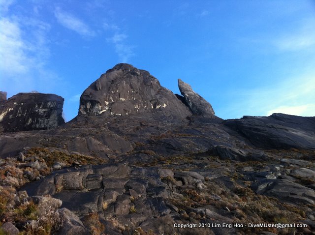
The rockface above the 11,000 feet altitude. These pictures were taken the following day when the weather was good in the morning to early afternoon.


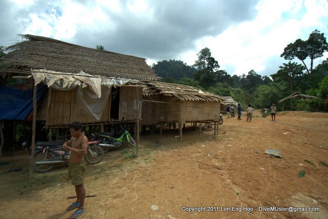
The trail started at Timpohon Gate. It had started to rain. It rained and rained and rained from the time we started until we reached Laban Rata at 11,000 feet. I do not recall having felt so wet, cold and miserable before. We had been on the trail and in the non-stop rain from 9.30am to 5.20pm. I was wet from both the rain and my sweat. Unfortunately my backpack raincover could not hold off the rain and that too with the contents were soaking wet. The only things that were dry were my Think-tank bags that held my camera gear.

Although we were totally soaked and cold, we decided it would be best that to get dinner at the Laban Rata Resthouse before heading to Pendant Hut, where we would be staying for two nights. Pendant Hut was another hundred or so (I didn't count actually) steps of wooden stairs up from Laban Rata resthouse.

That's our stay way up there...


This is from Pendant Hut looking down to Laban Rata Resthouse where we 1st arrived. The resthouse as dorms & few rooms for accommodation and the only restaurant 1t 11,000 feet to get meals. The meals don't come cheap due to the cost of bringing things up via porter.


Warmed up and into dry clothes, we had our Ferrata briefing before bunking down for the night. The next day would start early i.e. up at 1.45am and start the summit trek by 2.30am.

What could be worse than being wet, cold and miserable? Perhaps getting from warm dry clothes into the wet & cold clothing (including undies) at 2.00am in 11 deg Celsius temperature would be it!

God granted our prayers for good weather! The sky was clear and absolutely beautiful with stars!! Once a while on the trek up I would pause to admire the heavens. I wished I could just find a clear spot and lie there just to admire the starry sky.

This is all one would see until daybreak. Just the light from your torch to light your path:


My GPSr got unclipped and dropped off somewhere around the steep rope section. I heard it bouncing on the rock surface and stopped some 50 feet below. I decided to go back down to look for it. Find it I did and it still worked! Well used and abused unit :P

At Sayat-Sayat Hut & checkpoint, we decided not to press on to Low's Peak as time was tight if we wanted to do the Via Ferrata activity. We enjoyed the serenity and the unfolding beauty of the sunrise at 12,000 feet. The crescent moon rose just before sunrise and Venus was brightly visible.


The sea of clouds below was mesmerizing.

After the sun was high, we began our descent but not by the way we came up. This is what I really came for. This is the driving force for the return to Mt Kinabalu; Via Ferrata!!

A via ferrata (Italian for "road with irons") is a mountain route which is equipped with fixed cables, stemples, ladders, and bridges. For more info, please click on http://www.mountaintorq.com/index.php


View of the Via Ferrata (Walk the Torq route) from Pendant Hut. Look closer and you can see participants on the rockface. The white trail is the result from many shoes "cleaning" the rockface over the years.


The hanging bridge on Low's Circuit.


After 2 amazing nights, it was time to descend but not without getting some pictures along the way.


180 deg view of Laban Rata and surroundings below:


Porter carrying up a tankful of cooking gas for the restaurant and heating at Laban Rata:


Dew from the cold mornings:


I think I shall be back again but will not be waiting 18 years!